

Covehithe – The village lost to sea
Covehithe is a small village in East Suffolk, located on the North Sea coast between the more well known towns of Lowestoft and Southwold.
I had never heard of Covehithe until today when I was sent a YouTube video showing the damaging effects coastal erosion is having on this quaint village.
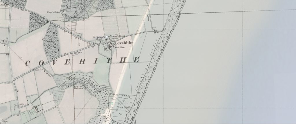
Everyone says a picture paints a thousand words, and in the case of Covehithe it really does. Mapping suggests the coastline at Covehithe has retreated around 530m since 1883. The following images are taken from the Groundsure GIS (Geographical Information System) showing the current coastline Ordnance Survey (OS) mapping, overlaid with historical OS maps and the Environment Agency’s National Coastal Erosion Risk Mapping and tell this story:
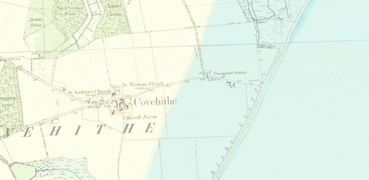
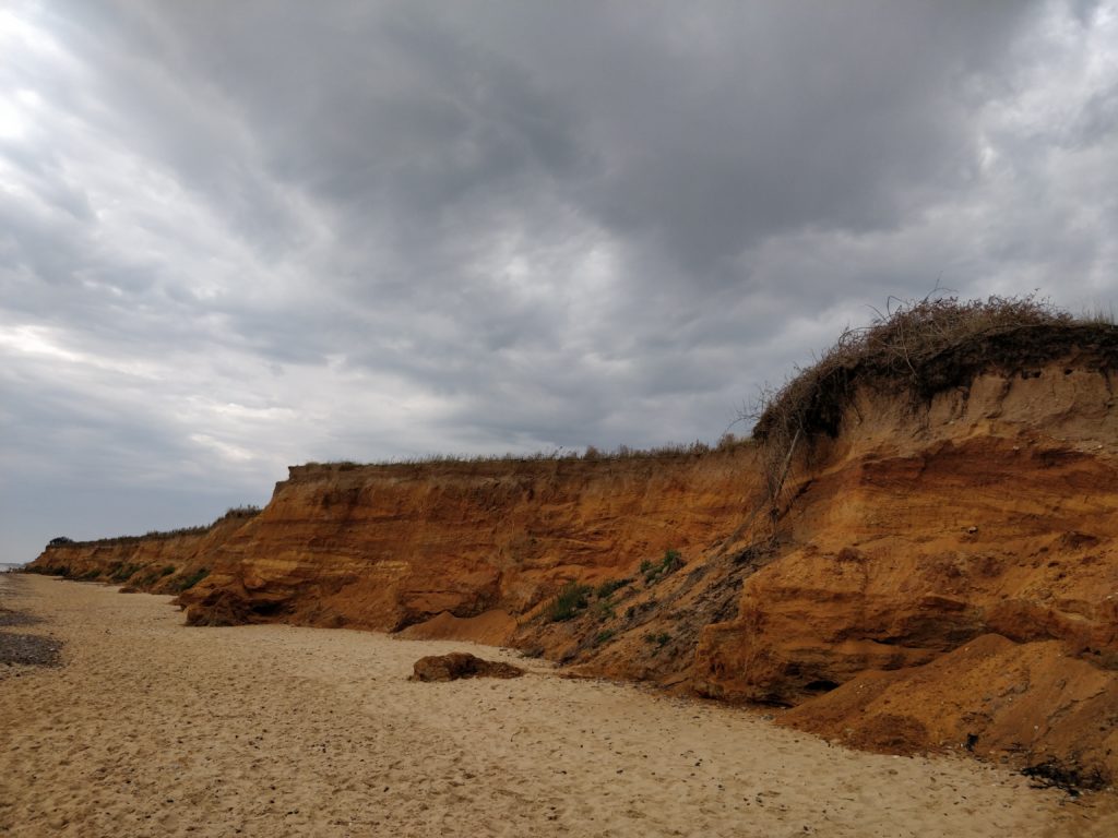
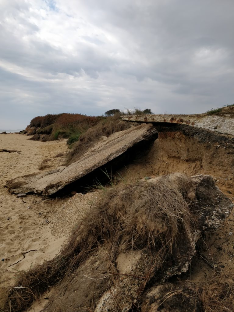
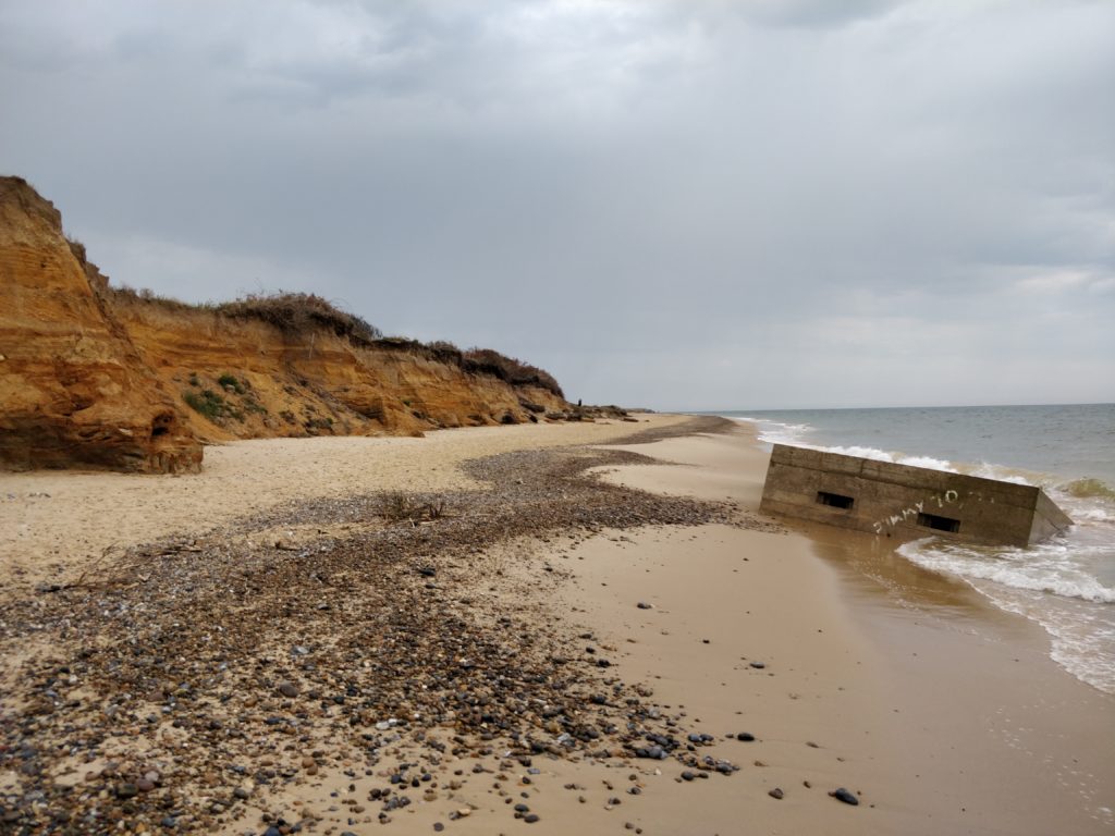
In 1883, the Covehithe Cliffs were well out to sea. By 1903 the cliffs had eroded approximately 75m, a further 80m had been eroded by 1927 which also saw the loss of the Lookout House. Only 20 years later a total of 250m had been lost to sea. Fast forward a few more decades to 1981 and we see the unfortunate loss of yet another building, this time the former Coastguard Station. Between 1981 and today around a further 175m had eroded away and this is set to continue. The effects can also be seen on these images taken by our very own GIS Manager Danielle Bouman only last year:
Whilst Covehithe may only be a small village tucked away in East Suffolk, it tells a stark and scary tale of how weather patterns are eating away our coastline and impacting upon the lives of many. Based on the Environment Agency’s National Coastal Erosion Risk Mapping, it is estimated that within 50-100 years a further 800m of the Covehithe coast will be lost, including the 400 year old Saint Andrew’s Church, part of the Benacre National Nature Reserve and Benacre Ness, as well virtually every single building left in the village. The area impact also stretches south to The Denes Beach at Southwold and north to Kingsland Beach.
Whilst this does not help the current residents of Covehithe, hopefully it helps future purchasers of property in coastal areas. When transacting on any property, correct due diligence should be undertaken. Don’t let your clients down by not ordering searches which could help predict the future of their most prized possessions. Section B 25.17 of the Law Society Conveyancing Handbook states “The incidence of subsidence and/or collapse events such as sinkholes is a growing risk for owners property. Where property and/or land is located within the influence of these hazards, it may be difficult to: Obtain a mortgage; Obtain suitable/affordable insurance cover, or; Sell the property.” it goes on to say that “A property should be searched to identify whether further investigation of site-specific ground instability risks is required. If a property is located within an area where ground instability risks are likely to occur, solicitors should consider further investigation of the risks present. This may include obtaining a site-specific report from a commercial search company.”
In September 2020 Groundsure launched their suite of GeoRisk Products and Hazard Alerts. The Hazard Alerts identify whether the property falls within the area of influence from a number of hazards including coastal erosion. The products themselves then provide full details of the risks identified. Using these in conjunction with one another removes the risk of negligence claims for your firm and ensures you provide your clients with the best in class products to aid in their decision making process.
At the end of the day, this is the single largest purchase a consumer will ever make. Don’t let yourself or your client down by falling short of the guidance.
Share:
Date:
Mar 17, 2021
Author:
Catherine Shiers